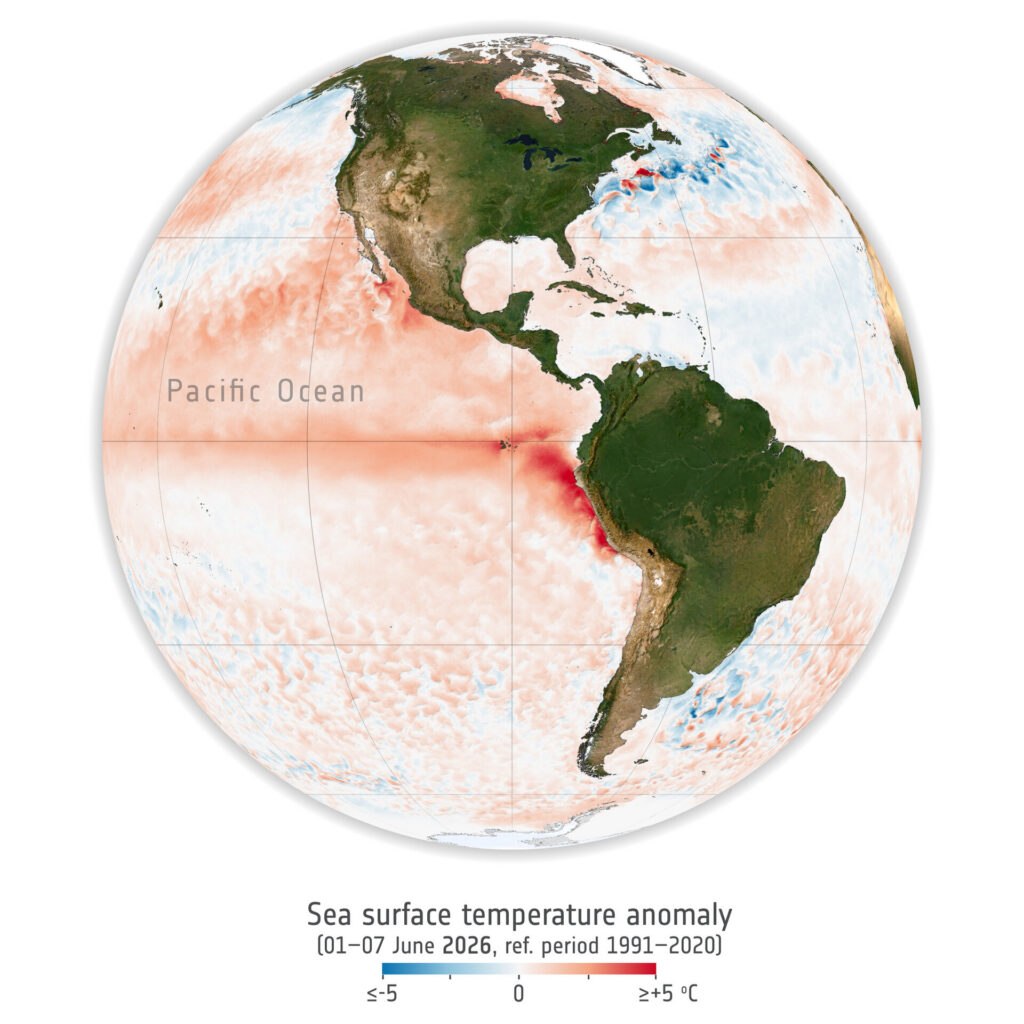
Global media are getting increasingly excited about what’s been coined the ‘Super El Niño’ now building in the Pacific Ocean. This sees the ocean temperature rise rapidly with plenty of consequences for the weather on land masses around the Pacific and for the overall global temperature. Opinion is divided, however, on how much influence the El Niño / La Niña cycle has on weather conditions as far away as Europe.
Most meteorologists seem to favour a view that the epicentre is too distant from The Alps to have a direct impact here,
“Some reports circulating claim that El Niño affects the Alps in the same way it does mountain ranges around the Pacific. It does not. The strength of El Niño or La Niña tells you almost nothing about how Alpine snowfall will play out, beyond its contribution to a generally warmer planet. Alpine winters are dominated by a different system much closer to home, the North Atlantic Oscillation,” a statement from Snow-forecast.com notes.
Now, however, the European Space Agency (ESA) has had their say, issuing a statement saying that in their view the strong El Niño does increase the risk of severe cold spells and snowstorms across Europe. Although there is an “if”.
“El Niño warms the tropical Pacific, and that extra heat can bring more rain there. But the effects don’t stop in the tropics. They can shift air patterns right across the planet, sometimes reaching all the way up to the stratosphere. When that happens, it can throw off Europe’s winter circulation too, and that’s often when we see colder winters,” an ESA spokesperson said, adding, “As the El Nino develops it can deliver a chain reaction in the atmosphere. Warm ocean water drives strong convection and planetary waves that disrupt the polar vortex, increasing the likelihood of sudden atmospheric warming, and weakening the jet stream. This can shape winter. In Europe, if the disrupted jet stream favours persistent high-pressure blocking, allowing cold Arctic air to move south, it increases the risk of severe cold spells and snowstorms across Europe and other regions.”
The ESA had previously published this overview of the event back in June.
In North America, where the impact of El Niño is a little more predictable (though still not guaranteed), ski areas are already heavily marketing the prediction that the system will push in more moisture and, hopefully, despite warmer temperatures, more snow. There are caveats even right next to the Pacific though, where some mountain ranges, such as the Sierras in California, tending to do well, whilst mountains further north sometimes, though not always, get less snow in an El Niño winter. And some El Niño winters have delivered the reverse of what’s expected.
We don’t have too long to wait to find out, the Super El Niño is currently predicted to peak as soon as late autumn, meaning the snowy abundance should be with us right at the start of the season, eradicating the usual nervous wait for the snow to arrive.